(Q)-Stabilizing the Ogallala Aquifer: Kansas’ Peer-to-Peer Learning Approach to Sustainable Irrigation

By Francie Fink

This story is part of a series on partnerships developed by the Midwest Big Data Innovation Hub with institutions across the Midwest through the Community Development and Engagement (CDE) Program.

The Ogallala Aquifer is an incredible feat of nature—a fresh groundwater resource that underlies eight states, or 174,000 miles. The Ogallala contains sediments deposited by flowing water six million years ago. Water percolates through the layer of hardened sediments and settles, recharging the aquifer’s groundwater layer. Since the early 1900s, humans have tapped the Ogallala’s underground reserves for water. The aquifer has become in many ways the backbone of the High Plains, a subregion of America’s Great Plains. Kansas is one state that still relies heavily on the Ogallala’s water. The livelihood of those in Western Kansas, in particular, are tied to the aquifer, as most of Eastern Kansas uses surface water for agricultural practices.

Problems arise when the rate of water withdrawal from the aquifer exceeds the rate of its recharge. The “thickness”—that is, the level of water—of the aquifer varies geographically. In Kansas, water levels have dropped, on average, 28.2 feet since the mid-20th century. By 2100, 24% of Kansas’ land could run out of water entirely. It’s not so surprising, then, that perhaps no other user group is more concerned with the rate of water withdrawal from the Ogallala than farmers. In Kansas, it’s both folks who produce crops and folks who raise livestock that have a stake in the water-conservation effort. That’s because these two industries depend on each other. In plain terms, “cows need food to eat.” At the core of the Ogallala water-level issue is irrigation—the practice of watering crops—in this case, with groundwater. The more efficient a farmer’s use of water, the lower the rate of depletion. But regulations governing water in Kansas are complicated. Most notably, as per the state’s Water Appropriation Act, all farmers using water for irrigation are required by law to obtain a permit and report yearly water usage or else pay a hefty fine and perhaps forfeit their water allocations for the following year. In times where water is scarce, the more senior permit holders have first dibs on water.

The North Plains Groundwater Conservation District’s (NPGCD) Master Irrigator (MI) Program trains and educates producers on advanced conservation practices in irrigation. The program began in Texas and has since expanded to Oklahoma and Nebraska. The 32-hour curriculum of the full MI program focuses on water and energy conservation and doesn’t sacrifice producers’ goal of profit maximization. The blueprint of this program is well known to Kansas State University’s (K-State) Kansas Center for Agricultural Resources and the Environment (KCARE), where director Suzan Metzger and irrigation specialist Jonathan Aguilar have long sought a venue and curriculum that allows producers and processors to share regionally specific best practices for irrigation. But developing a Kansas-specific full MI Program requires extensive time and resources. The K-State team wanted to get the conversation started right away.

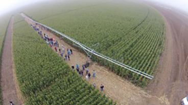
A working farm in western Kansas using recommended irrigation technology
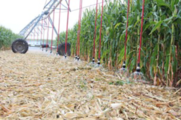
Pivot nozzles used for water conservation in irrigation systems

Pictured Left: Field day in western Kansas, where the public was invited to visit a working farm to see recommended irrigation technology in practice. Photo Credit: Grace Roth, Kansas State University.
Pictured Right: Pivot nozzles used for water conservation in irrigation systems. Photo Credit: Grace Roth, Kansas State University.


Metzger’s team partnered with the Midwest Big Data Innovation Hub (MBDH) to develop their own program, called “Master Irrigator Lite.” This bite-sized, day-long event was introduced in February 2024 to (1) engage producers and processors in best-practice sharing for irrigation and (2) establish a steering committee to plan curriculum for future iterations of the MI Program in Kansas.

“MI Lite was intended to spur the interest of the producers. It was a shorter version of what the full program would be,” said Aguilar, Professor and Water Resource Engineer at Kansas State University. “We tried to understand what producers are doing already and asked what they would like to see if the full program was implemented in Kansas. Producers are eager to implement something similar to what other states are doing, but Kansas will have a slightly different flavor than other states, in part because we are so data rich.”

Participants and program staff spoke on lots of water-related topics at the MI Lite Program, but conversation centered around one particular water-conservation practice, called the “Q-stable approach” to irrigation. Remember how Kansas has so many regulations around agricultural water use? A benefit of that system, although it is complex, is that the Kansas Geological Survey (KGS) uses data from mandated water meters to determine and map aquifer levels across the state. The KGS uses reported water usage to determine how far off a district, county, or township is, on average, from pumping water at a sustainable rate. That annual water usage that results in a sustainable pumping rate is called the Q-stable rate (in acre-feet per year). The methodology takes into account water inflows (recharging the aquifer) and outflows (pumping). Geographies are categorized as either above or below the Q-stable rate, and individual water usage can be benchmarked against the goal Q-stable rate for the next year. This evidence-based approach to water management is both effective and easy to adopt. While new water-saving nozzles and evaporation-reduction technology can be useful, it involves investment and substantial operational changes.

“The value that the Ogallala Aquifer has and continues to bring to all Kansans is unmeasurable,” says program participant and farmer, Brant Peterson. “For generations it has been the lifeblood of the economy as well as the people that drive the economy. We have a responsibility to our previous and future generations to make some changes to ensure the life of the aquifer.” Peterson continued, “The Kansas Master Irrigator Lite event I attended was exciting to see a regional group that was focused on coming up with workable solutions to conserve water and sustain economic viability for everyone.”

The MI Lite Program was a success, according to its participants and program coordinators. Twenty-two livestock and row-crop producers and processors from Western Kansas came for a full day of practice sharing, panel discussions, and networking. Several other regional partnerships were represented at the event, including the Kansas Geological Survey, Kansas Department of Agriculture, and Groundwater Management District 3. Overall, participants were energized by the peer learning. A post-event survey showed promising results for the continuation of this learning and practice sharing. All participants said that the event helped them to learn more about local hydrology and how water use impacts the Ogallala Aquifer, and 60% of participants indicated they were interested in serving on an advisory committee for the future of the MI Program in Kansas. The K-State team is now hoping to host a series of distinct workshops for farmers that will give them “microcredentials” in the Q-stable methodology and other water-conservation practices.

Learn More/Get Involved

Learn more about Kansas State’s Master Irrigator Lite Program here.

Contact the Midwest Big Data Innovation Hub if you’re aware of other people or projects we should profile here, or to participate in any of our community-led Priority Areas. The Midwest Big Data Innovation Hub is an NSF-funded partnership of the University of Illinois at Urbana-Champaign, Indiana University, Iowa State University, the University of Michigan, the University of Minnesota, and the University of North Dakota, and is focused on developing collaborations in the 12-state Midwest region. Learn more about the national NSF Big Data Hubs community.
South Dakota Mines Students Help Collect Data for Missouri River Pipeline Study

By South Dakota Mines

This story is part of a series on partnerships developed by the Midwest Big Data Innovation Hub with institutions across the Midwest through the Community Development and Engagement (CDE) Program.

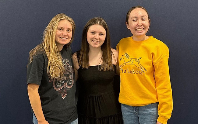
Annika Schooler, Ashley Walker, and Ava Knutson
South Dakota Mines students Annika Schooler, a civil and environmental engineering graduate student; Ashley Walker, atmospheric and environmental sciences; and Ava Knutson, civil engineering, collected and analyzed data from hundreds of smaller water systems as part of the larger Western Dakota Regional Water System Missouri River pipeline project.

A group of South Dakota Mines students spent several months collecting and analyzing data from hundreds of smaller water systems that will eventually connect to an extensive pipeline supplying water to most of western South Dakota.

The students worked with the team at Western Dakota Regional Water System (WDRWS), a nonprofit organization formed in 2021 to plan, construct, and manage the delivery of Missouri River water to communities, tribes, and other rural water systems throughout West River.

“This project is looking at the Missouri River water and making sure everybody has quality, abundant water no matter where they live in western South Dakota,” said Cheryl Chapman, Ph.D., WDRWS executive director.

The research opportunity was funded through Elevate Rapid City, thanks to funding from the Midwest Big Data Innovation Hub, a network of people from academia, industry, government, and nonprofits focused on using data-driven approaches to address challenges facing science and society.

Taylor Davis, Elevate Rapid City’s senior workforce development and partnerships director, said the project-based learning experiences were open to students at higher-education institutions throughout Western South Dakota and across multiple disciplines.

“Among the five students, we had three different majors. That really provides a unique perspective,” Davis said. “These are real-world issues that these students are working on. They can apply what they learn in a classroom setting to practical application.”

The project involved research into the current water systems available throughout western South Dakota, said Annika Schooler, a civil and environmental engineering graduate student who worked on the WDRWS project. “We looked at how many systems there were, then ways in which these individual water systems could be combined into one greater system to conserve water and cost,” she said.

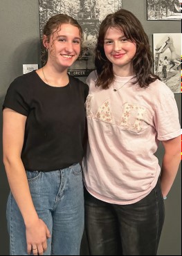
Piper Kocina and Molly Comfort

Schooler; Ashley Walker, atmospheric and environmental sciences major; Ava Knutson and Molly Comfort, both studying civil engineering; and Piper Kocina, geology major, worked closely with Chapman; Corey Chorne, an engineer with AE2S and program manager for the WDRWS engineering team; Mark Meyer, director of water for the state Department of Agriculture and Natural Resources; and Jennifer Sietsema, executive director for Black Hills Council for Local Governments.

“Our goal with this grant is a multidisciplinary approach to complex community problems,” Chapman said. “Part of what they have been involved with is understanding the governance structure we have for water at the state and local levels and then collecting and working with the data to understand what challenges exist.”

With the engineering team focusing on the larger water systems, the students broadened the project scope by researching the area’s smaller systems, Chorne said.

The next step is to pull the data and chemistries of the different water sources and make sure everything is compatible. “We need to do our due diligence to make sure the waters will behave together, and if they don’t then we will have to look at the treatment methods,” Chorne said.

Mines students have been invaluable to WDRWS, and the goal is to have them continue working on the large-scale water project even after graduation, Chorne said. “We are grateful to this local resource available to us so we can start building our team locally to work on this long term.”

Schooler said it was interesting to work on such an extensive project and understand all the background needed for the plan to move forward. “This was a great opportunity to meet and learn from some great professionals, learn about the water systems throughout western South Dakota, and figure out how we could solve problems in conserving water.”

Mines faculty and students have been involved with the Missouri River water study since 2017, when the West Dakota Water Development District commissioned a study with the university on the value of renewing its future use water permit. In 2019, Mines recommended renewal and further analysis on bringing the Missouri River water to western South Dakota.

From Marine Biologist to Antarctic Explorer: Fay Couceiro’s Quest to Understand Microplastics

By Shruti Gosain

Navigating the challenges and discovering solutions for environmental health along with exploring the impact of tiny particles on Antarctica and beyond.

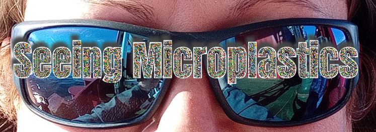
Close-up of Fay Couceiro with sunglasses, with the words "Seeing Microplastics."


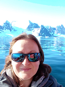
Headshot of Fay Couceiro in Antarctica.

Fay Couceiro, whose journey has taken her from the shores of marine biology to the expansive landscapes of environmental science, is a biogeochemist who studies microplastics. She has traveled all over the world to understand how microplastics affect our environment. Her work took her from the Caribbean and Southeast Asia to Africa and the UK. However, one destination remained unchecked on her bucket list—the polar regions. Pushing her boundaries even further, she has recently ventured into the icy depths of Antarctica to understand how tiny plastic particles are impacting this remote corner of the Earth.


Ice-covered landscape in Antarctica.


But what exactly are microplastics, and why are they such a big deal?

We know that plastic is everywhere in our lives, from wrapping our vegetables to holding water. Since it was invented in the early 1900s, plastic production has skyrocketed. People worldwide buy a million plastic bottles every minute and use 5 trillion plastic grocery bags every year! The problem is, while plastics are convenient, they’re also harmful to our health and the environment. Plastic is lightweight, flexible, and long-lasting but here’s the kicker: plastic doesn’t just disappear. A plastic water bottle, for example, might break into smaller pieces over time, but it could take around 450 years or more to fully disappear. This means that the very first plastic items ever made are still around somewhere on Earth.

Microplastics are tiny pieces of plastic less than 5 millimeters in size that have become a widespread environmental concern. Microplastics are now found everywhere, from the Antarctic snow to remote deserts. Even smaller nanoplastics float in the air we breathe and the oceans we fish in. They can originate from the breakdown of larger plastic items due to exposure to environmental factors like sunlight and water. The primary materials making up microplastics include polymers like polyethylene, polypropylene, and polystyrene, which are commonly used in the production of various plastic products. Despite their size, microplastics pose significant threats to ecosystems and human health.

So, back to Fay’s Antarctic adventure. Recently, she got a chance to study microplastics in Antarctica on a Royal Navy ship, the HMS Protector. Contrary to expectations, the Antarctic summer wasn’t as freezing as one might imagine, with average temperatures hovering around 33–36°F (1–2°C). “It was the summer and it was not nearly as cold as you would think it would be. I actually went outside on deck in a thermal and a jumper some days. When there’s no wind it is about one degree,” says Fay.

Sunset on Antarctic coastline.


But despite the milder weather, it was an adventure nonetheless. The Royal Navy provided everything needed for the research, making it a unique opportunity. Here, she collected diverse data, focusing on pollutants like nutrients, heavy metals, and microplastics. However, collecting samples in Antarctica posed challenges. The collection process involved a meticulous balance of technology and simplicity. The water samples were obtained with buckets and bottles, but specialized tools such as plankton nets and sediment grabs were used to ensure accurate sampling of microplastics without contamination from the ship’s materials.

Now, why is studying microplastics so crucial, you ask?

Well, because they’re everywhere, and their presence raises concerns about their impact on wildlife and human health. These tiny plastics may seem insignificant, but their omnipresence is cause for alarm. Through her work, Fay hopes to shed light on the pervasive nature of microplastics and inspire action to mitigate their impact. So, the next time you unwrap a plastic package or sip from a disposable water bottle, remember Fay’s Antarctic adventure and the vital importance of understanding the hidden world of microplastics.

Microplastics are more than just small plastic!

Surprisingly, even though we produce millions of tons of plastic each year, we know very little about the health effects of microplastics. “The smaller the particle, the more damage it can do,” says Fay. Fay states that these microplastics can also carry chemicals from the environment, making them harmful when animals eat them. In aquatic invertebrates, the impact of microplastics is alarming. They contribute to a decline in feeding behavior and fertility, impede larval growth and development, elevate oxygen consumption, and stimulate the production of reactive oxygen species. Fish, too, face detrimental effects, including structural damage to the intestine, liver, gills, and brain. Microplastics can disrupt metabolic balance, alter behavior, and affect fertility in fish, with the severity of these consequences depending on particle size, dosage, and exposure parameters.

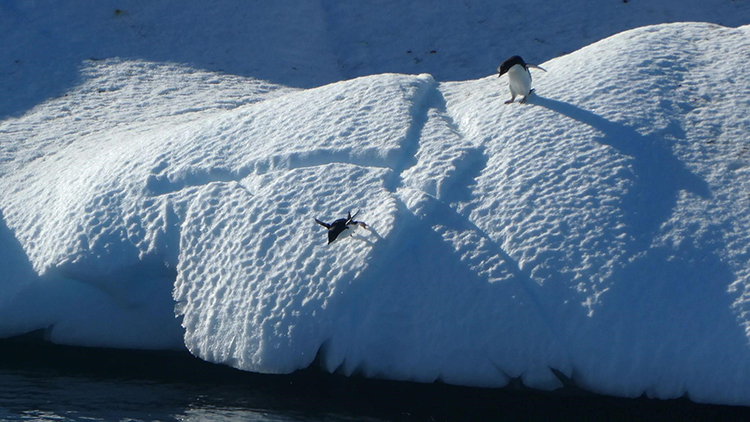
Penguins jumping off an iceberg in Antarctica.


Fay also found that bacteria stick to microplastics, creating a slimy layer called a biofilm. If that biofilm contains pathogens, it can harm marine life. She wants to figure out how much harm microplastics can cause and how to stop it. Understanding the intricate web of harmful effects caused by microplastics is crucial for developing comprehensive strategies to mitigate their impact on both human health and aquatic ecosystems.

Now, we cannot completely neglect plastics. Since their invention over a century ago, plastics have become part of our daily lives. “I genuinely don’t believe we will eliminate all plastic because it is a ridiculously useful material,” says Fay. But we make and use so much plastic that plastic pollution is now a big concern. While some plastics can be recycled, others pose real challenges to the recycling process. Of those plastics that are easy to recycle, few are considered feasible. Most are thrown into landfills, where they break down over time into smaller pieces. These have seeped into our oceans and waterways, so tiny plastic bits are showing up in some seafood. And when we wash fabrics made of plastics like nylon or polyester, plastic bits can blow out of our dryers, adding to air pollution. Scientists have found microplastics in human blood, lungs, guts, and feces. They’ve also been seen in breast milk!

Good and Bad Plastics

“So, what’s the concentration of microplastics that poses harm to either humans or ecology, and how close are we to that threshold?” Fay inquires. “Let’s say it’s 100 microplastics per liter that causes problems, and we’re currently at 50. How do we ensure we don’t reach 100? That’s a tremendously challenging question,” Fay adds. She stresses the importance of removing large plastics before they break down into microscopic particles, as oceanwide filtration would be impractical. Larger pieces of plastic in the sea or on land become brittle and gradually break down. This is due to sunlight, oxidation, or friction, or by animals nibbling on the plastic. This plastic breakdown process goes on forever, although the speed depends on the circumstances. There are beaches where you not only see large pieces, but also countless fragments, colored or faded, and the smallest pieces can no longer be distinguished from grains of sand.

Now, we know that we could never completely eliminate plastic use, and we shouldn’t try to. What’s interesting is that scientists often study bigger pieces of plastic because it’s easier, even though the small ones might be causing more damage. It is, therefore, necessary for us to understand the composition and recyclability of different types of plastics and how essential it is for effective waste management and environmental conservation efforts. There should be awareness about good and bad plastics in the community. Fay believes that when people know more about microplastics, they care more. She reminds us that simplifying the types of plastics we use and focusing on the ones we really need can really make a lot of difference. This care can lead to changes in rules and policies. “We have had engagement with policymakers and are working with our policy groups,” says Fay. Fay has talked to important people who make decisions, hoping to influence them with her research.

So, fixing plastic pollution isn’t as simple as just picking up trash. We need to understand all the ways plastic harms the environment and come up with smart plans to stop it.


What Does the Future Hold?

“We’ve seen a significant rise in Antarctic tourism over the past three decades, with the number of visitors doubling each decade. While this might initially sound impressive, it’s also a cause for concern. Managed properly, ecotourism can bring substantial benefits, especially if visitors become advocates for preserving Antarctica. However, if large cruise ships fail to follow regulations and leave behind pollutants like metals, microplastics, and sewage, it poses a serious problem. We need effective monitoring and enforcement to maintain the pristine condition of this fragile environment.”

–Fay Couceiro

International cooperation and collaboration are crucial in Antarctica, where tourism is increasing and environmental impacts are a concern. Microplastics harm Antarctic life by entering the food chain, affecting the health of organisms and making them less able to cope with climate change.

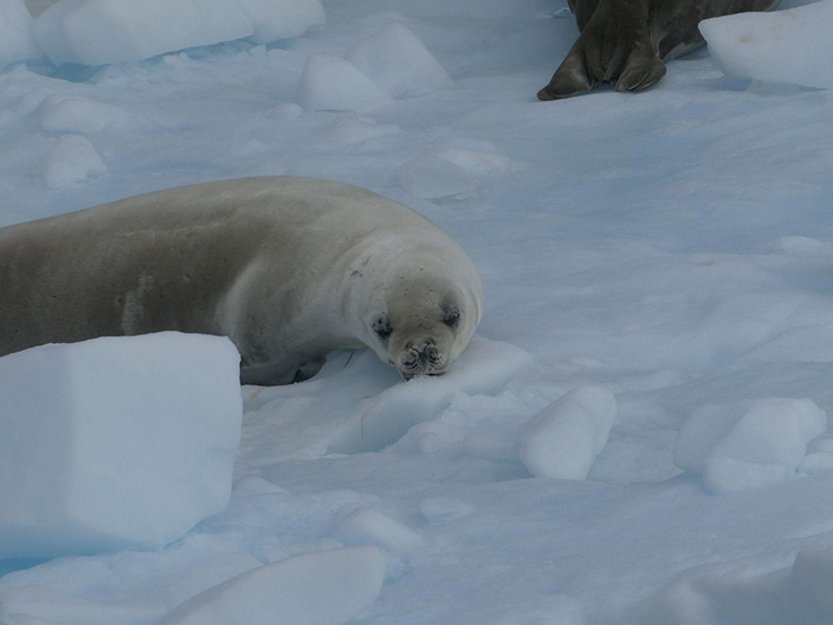
Seal on the ice in Antarctica.


Fay delved into ongoing research efforts, shedding light on the exploration of enzymatic breakdowns as a promising solution to the microplastic issue. “There are chemical methods available for eliminating plastics, but they tend to be costly and not very efficient, especially when dealing with microplastics,” says Fay. However, she emphasized the considerable challenge of scaling up these processes effectively. “We have enzymes that can eat plastic and separate them into their smaller monomers. But how do we do that on an industrial scale? And how would we do that with a mix of them? We can’t separate them out into the perfect laboratory conditions. So how do we scale that up?” asks Fay. Moreover, she also underscored the critical importance of monitoring human activities, particularly those associated with cruise ships, in delicate ecosystems like Antarctica. This interactive approach not only engages but also prompts reflection on our collective responsibility to safeguard these precious environments.

Fay hinted at exciting future endeavors, including a groundbreaking comparative study between the Arctic and Antarctic regions. Such an exploration promises to unveil crucial insights into how human activities impact these pristine polar environments. As we delved deeper into the conversation, it became evident that Fay’s passion lies in unraveling the intricate relationship between human actions and environmental health. She articulated a pressing need for a paradigm shift, urging us to move beyond short-sighted monetary gains and prioritize the long-term well-being of our planet.

But what exactly is at stake? Consider this staggering statistic: people worldwide purchase a million plastic bottles every minute, while a mind-boggling 5 trillion plastic grocery bags are consumed annually. These numbers paint a stark picture of our reliance on plastic convenience items. Yet, convenience comes at a cost—one that’s detrimental to both our health and the environment.

It’s a problem exacerbated by an industry that thrives on the production and distribution of plastics, raking in over $600 billion annually. This financial incentive fuels a cycle of consumption, production, and waste that threatens the very ecosystems we depend on. However, amid the grim realities, Fay’s work offers a beacon of hope. By unraveling the mysteries of microplastics and shedding light on their impact, she empowers us to make informed choices for a cleaner, healthier planet. Her optimism stems from the belief in humanity’s collective ability to address environmental challenges through collaborative efforts.

As we reflect on Fay’s insights, it becomes clear that the microplastic challenge isn’t just an isolated issue. It’s a symptom of a broader problem that requires urgent attention. It’s a call to action, urging us to rethink our consumption patterns, advocate for sustainable practices, and hold industries accountable for their environmental footprint. In the end, Fay Couceiro’s work serves as a reminder of our shared responsibility to safeguard the planet for future generations. It’s a reminder that by working together, we can pave the way towards a more sustainable and prosperous future.

Get Involved

Contact the Midwest Big Data Innovation Hub if you’re aware of other people or topics we should profile here, or to participate in any of our community-led Priority Areas. The MBDH has a variety of ways to get involved with our community and activities, including our cross-sector Water Data Forum webinar series, which recently had a session on microplastics and AI.

The Midwest Big Data Innovation Hub is an NSF-funded partnership of the University of Illinois at Urbana-Champaign, Indiana University, Iowa State University, the University of Michigan, the University of Minnesota, and the University of North Dakota, and is focused on developing collaborations in the 12-state Midwest region. Learn more about the national NSF Big Data Hubs community.
BlueGAP: A Community-Driven Movement Against Nitrogen Pollution

By Shruti Gosain

We all love the tranquility of our water bodies, but there’s a silent threat lurking beneath the surface. Nitrogen pollution! Nitrogen pollution is also called the hidden troublemaker of our water system. It’s not something we can see, but it’s a big problem for our precious water resources. Nitrogen pollution comes from natural processes and things we do, such as farming and industry. It comes in forms like ammonia, nitrate, and nitrite. While nitrogen is important for life, having too much of it in our water is a problem. One of the major drawbacks is the promotion of accelerated growth of algae and other aquatic vegetation. This excessive growth, fueled by the abundance of nitrogen, can result in harmful algal blooms that have detrimental effects on aquatic ecosystems. These blooms not only alter the balance of the ecosystem but also pose threats to the living organisms within it. What makes it worse is that it hits vulnerable communities the hardest. These are often people who already face challenges, and they rely on this contaminated water. That means more health problems, harm to the environment, and financial troubles. This, in turn, leads to more health problems, harm to the environment, and financial troubles for these communities. Nitrogen pollution becomes not just a hidden troublemaker but a pressing issue with far-reaching consequences.

It is said that recognizing a hidden threat is often the first vital step in dealing with it. The U.S. National Science Foundation (NSF) is taking a significant stride in addressing major global challenges such as climate, sustainability, food, energy, pollution, and the economy. According to Douglas Maughan, the head of the NSF Convergence Accelerator program, this initiative involves a range of approaches, including human-centered design, user discovery, team science, prototyping, storytelling, and pitch preparation.

The Convergence Accelerator program is focused on themed tracks. The Networked Blue Economy track is one of the most mature tracks, with a substantial $30 million investment to advance six research teams from Phase 1 to Phase 2, made in September 2022. This underscores the importance of the blue economy in addressing pressing ocean-related challenges, including plastic waste and coastal erosion.

About BlueGAP
One standout Phase 2 awardee is the Blue-Green Action Platform (BlueGAP) project, led by the University of South Florida. In a groundbreaking initiative to address nitrogen pollution and its impact on communities from the upper Mississippi River to the Florida Gulf, the BlueGAP project leveraged the innovative power of mixed-media art to communicate the environmental challenges. The project enlisted the expertise of graduate students from arts and humanities programs, empowering them to explore various storytelling avenues around nitrogen pollution. With creative freedom and access to stakeholders in Iowa watersheds, the resulting artwork seamlessly integrated with data and narratives on nitrogen pollution. As a Professor of English at the University of Iowa, Eric Gidal led a team of graduate students in creating a unique art exhibit in Iowa. This exhibit, called “Fluid Impressions,” combined sculptures, art books, and digital formats to tell stories about nitrogen pollution and inspire action. The intended audience included Iowans actively involved in water-quality issues, University of Iowa faculty and students, and curious members of the general public.

“I think the exhibit succeeded in calling attention to the problem of nitrogen pollution,” Gidal said, “connecting people to an evolving network of resources, and showcasing some very innovative work from talented young artists, writers, and scholars. I would also say that it successfully demonstrates the many benefits of truly cross-disciplinary projects, in this case connecting hydrology and engineering with ceramics, choreography, book arts, journalism, literary studies, and creative nonfiction to produce a meaningful engagement with the wider community.”

At the heart of the BlueGAP project lies a unique and powerful approach that has sparked a noteworthy reaction from communities—a fusion of storytelling and data-driven insights. Unlike traditional initiatives that either emphasize storytelling or focus solely on data dissemination, BlueGAP ambitiously intertwines narratives from communities grappling with daily challenges of nitrogen pollution with rigorous and relevant watershed impact data. What sets BlueGAP apart is its commitment to not only raise awareness through storytelling and provide data to the public but to catalyze tangible actions, particularly in the realms of policymaking and decision-making. The project stands out as a beacon of innovation, recognizing that the convergence of narratives and data can be a catalyst for positive change.

“One of the most unique things about this project is the way storytelling, focused on the first-hand experiences of communities confronted with nitrogen pollution on a daily basis, really lies at the heart of what BlueGAP is all about,” said Rebecca Zarger, a professor in the Department of Anthropology at the University of South Florida, and a co-principal investigator on the BlueGAP project. “Our purpose is to connect those with stories to tell with one another and with the most rigorous and relevant data possible about watershed impacts from nutrients. There are projects that emphasize storytelling and those that focus on bringing data to the public, but fewer organizations are leveraging the power of simultaneously connecting stories and data to action, in the form of policymaking and decision-making.”

BlueGAP brings together a diverse group of academic, nongovernmental, quasi-governmental, and community organizations to raise awareness about the nitrogen pollution crisis and its impacts. This initiative connects community organizations across watersheds, addressing economic and health challenges caused by nitrogen pollution. BlueGAP partners with frontline community organizations to explore various funding sources to ensure initiatives aimed at improving water quality and ecosystem health have the necessary resources.

BlueGAP’s core model focuses on local experiences and knowledge, highlighting the costs and benefits of actions at specific leverage points in nitrogen management. The overarching vision of BlueGAP is to accelerate the convergence of best practices for nitrogen management and, by extension, stimulate the Blue and Green Economies. This initiative focuses on four key objectives:

  • 1.  Advanced Human-Centered Design: BlueGAP places human-centered design at the forefront of its approach because solutions to pollution are most effective when designed with people in mind.
  • 2.  Storytelling and Science: By weaving storytelling with cutting-edge scientific evidence, BlueGAP identifies pivotal points for action, ensuring that facts resonate with the public.
  • 3.  Inclusive Educational Materials: Education is the cornerstone of change. BlueGAP is committed to creating inclusive educational materials that impact nitrogen management and engage communities.
  • 4.  Establish a Sustainability Plan: To ensure the longevity of its mission, BlueGAP lays the groundwork for a sustainability plan that will see its efforts continue well into the future.

So, BlueGAP is not just another environmental initiative; it is a dynamic, community-driven movement. It leverages the power of collaboration, communication, and innovation to tackle the pressing issue of nitrogen pollution. BlueGAP’s mission reflects on NSF’s commitment to supporting initiatives that demonstrate intellectual merit and broader impacts, recognizing that the health of our watersheds is vital for a sustainable and thriving future. With BlueGAP leading the way, the path to a cleaner, healthier, and more sustainable Blue Economy has become clearer.

BlueGAP Co-Principal Investigator Maya Burke says that in propelling the BlueGAP Academy forward, one standout stakeholder has played a pivotal role—Hillary Van Dyke, Director of Opportunity and Access at Impact Florida. Her impact reverberates through the Tampa Bay region, where she has been a driving force in introducing Black communities to the wonders of wild places. Her multifaceted contributions showcase the power of individual dedication and community engagement in advancing the goals of BlueGAP, aligning with the project’s commitment to inclusivity, environmental awareness, and positive change.

Through collaboration with community leaders in Iowa, Tampa Bay, and St. Croix, the project has learned that stories play a pivotal role in building trust and motivating collective action. By producing high-quality videos with American Sign Language (ASL) translation, BlueGAP aims to share diverse perspectives connected to nitrogen pollution. These stories, coupled with accessible water quality data, serve as compelling tools to engage and mobilize communities.

Role of Data
The project is actively building a qualitative database, intertwining personal narratives with water-quality metrics, to create a dynamic platform that not only informs but inspires meaningful action toward improved nitrogen management within and across watersheds. In essence, BlueGAP’s commitment to the simultaneous integration of storytelling and data-driven approaches marks a transformative shift in environmental initiatives, demonstrating the potential for a more comprehensive and impactful engagement with communities. With a strong focus on the Networked Blue Economy, this program is diving into areas such as water, agriculture, and community well-being. Let’s break it down!

Water: This program is all about improving how we monitor and manage water resources. That means cleaner water, better resource allocation, and sustainable practices—a win for everyone.

Agriculture: The Convergence Accelerator program brings experts together to create data-driven solutions for agriculture. Weather patterns, soil conditions, and crop performance all help farmers make smarter decisions. Think higher productivity, less waste, and greener practices!

Community: In our neighborhoods, data and information matter, especially for healthcare, education, and our overall quality of life. This means healthier living, improved education, and easier access to community services.

So, what’s the connection between data systems and these critical areas? Well, it’s all about making things work together. Maya Trotz, Principal Investigator of BlueGAP, says that storytelling has been a key way to bring together these technical threads in ways that build local community engagement.

“Empowering communities to take actions on any issue requires a certain level of trust and willingness to work towards a common goal—for BlueGAP, that is improving how we manage nitrogen within and across watersheds,” said Trotz. “Working with community leaders in Iowa, Tampa Bay, and St. Croix, we quickly learned that stories were critical for building trust. When coupled with accessible water-quality data, those stories could really motivate others to take action. So, we are producing high-quality videos with ASL translation to tell stories of people who are connected to nitrogen pollution from many different angles. We are building a qualitative database with these stories and connecting that to our water-quality data.”

By bringing these elements into sync, the Convergence Accelerator program aims to create positive changes, not just for the Networked Blue Economy but for anyone who relies on clean water. The program’s approach is all about connecting the dots and using data to drive solutions in these vital sectors. That’s not just a win; it’s a win-win for everyone involved. Also, bridging the gap between scientific knowledge and public engagement is the impactful documentary film, “Harm in the Water,” led by Tiara Moore, CEO of Black in Marine Science. It serves as a powerful tool for BlueGAP, translating technical information into an accessible format. This film emerges as a beacon, engaging citizens and making complex data more understandable.

BlueGAP and MBDH
“Water quality is a key topic of concern to our communities in the Midwest and Great Lakes regions,” said John MacMullen, Executive Director of the Midwest Big Data Innovation Hub, who is also a member of BlueGAP’s Advisory Board. “It impacts human and animal health across the spectrum from rural to urban populations, and we know that water crosses state boundaries, leading to impacts elsewhere, such as the Florida Gulf Coast. We think BlueGAP’s innovative storytelling approach is a great way to raise public awareness of water-quality challenges and how they impact local communities.”

The shared interests between the BlueGAP and MBDH communities provide opportunities for future collaboration, both in storytelling and other programmatic activities, such as the Water Data Forum, a cross-sector venue for sharing best practices and new innovations in water data. The next session of that webinar series will be in April 2024, and will be focused on data and AI for contaminant remediation.

Conclusion
BlueGAP stands at the forefront of environmental initiatives, unraveling the complexities of nitrogen pollution through a remarkable fusion of storytelling and data-driven insights. This project exemplifies a commitment to tackling global challenges innovatively. The project’s holistic model, encompassing local experiences, human-centered design, and inclusive educational materials, positions it as a community-driven movement making tangible strides. As BlueGAP continues to address nitrogen pollution, it not only enhances water-quality understanding but also empowers communities, exemplifying the potential of convergence in shaping a sustainable and thriving future for our watersheds.

Get Involved

Contact the Midwest Big Data Innovation Hub if you’re aware of other people or projects we should profile here, or to participate in any of our community-led Priority Areas. The MBDH has a variety of ways to get involved with our community and activities, including our cross-sector Water Data Forum webinar series.

The Midwest Big Data Innovation Hub is an NSF-funded partnership of the University of Illinois at Urbana-Champaign, Indiana University, Iowa State University, the University of Michigan, the University of Minnesota, and the University of North Dakota, and is focused on developing collaborations in the 12-state Midwest region. Learn more about the national NSF Big Data Hubs community.
NSF-Funded Hubs Partner to Develop the Water-Energy Nexus Open Knowledge Network

By Kimberly Bruch, San Diego Supercomputer Center Communications

The National Science Foundation (NSF) has funded a three-year cooperative agreement award of $1.47 million to create the Water-Energy Nexus Open Knowledge Network (WEN-OKN). This project involves impactful work across the West and Midwest Big Data Innovation Hub regions.

NSF logo.

“We are excited to bring together a team of partners with diverse backgrounds and representing multiple sectors, to develop WEN-OKN. It will connect data from vital water and energy systems, and help answer complex questions at the water-energy nexus,” said Principal Investigator (PI) Lilit Yeghiazarian, a professor of environmental engineering at the University of Cincinnati. “ WEN-OKN will become an integral part of critical national data infrastructure.”

The WEN-OKN has two primary goals: 1) create a knowledge graph that interconnects water and energy data throughout the nation and 2) explore ways to mitigate issues that evolve within these connections. The datasets being integrated into WEN-OKN include databases from the United States Geological Survey (USGS), National Oceanic and Atmospheric Administration (NOAA), Department of Energy (DOE), United States Environmental Protection Agency (USEPA), Federal Emergency Management Agency (FEMA), Department of Transportation (DOT), National Aeronautics and Space Administration (NASA), and the United States Army Corps of Engineers (USACE).

West Hub’s Ilya Zaslavsky, who is the director of the Spatial Information Systems Laboratory at the San Diego Supercomputer Center (SDSC) at UC San Diego, is a co-principal investigator along with the Arizona State University’s Center for Science, Technology and Environment Policy Studies Director Eric Welch.

The Midwest region is represented by PI Yeghiazarian as well as two co-PIs: University of Cincinnati’s Head of Department of Computer Science, College of Engineering and Applied Science Justin Zhan and Siddharth Saksena, who is an assistant civil and environmental engineering professor at Virginia Polytechnic Institute and State University (Virginia Tech).

“One of our key technical goals with WEN-OKN is to develop a unified semantic and spatiotemporal framework and create services for extracting energy- and hydrology-specific entities and spatial relationships from multiple databases,” Zaslavsky said. “Integrating these data into federated knowledge graphs will help multiple agencies to get answers to regulatory and policy questions for enhanced water and energy resilience.”

“This work is critical to the Midwest region of the U.S.,” said John MacMullen, Executive Director of the Midwest Big Data Innovation Hub. “The connections between water and energy in the Great Lakes region are key drivers for water quality, climate resilience, and agriculture. We are excited to see the impact this work will have on integrating knowledge from disciplines that are deeply connected but often isolated in specialized domains and repositories.”

The WEN-OKN has been funded by the NSF (award no. 2333726).

Overcoming Cybersecurity and Interoperability Challenges in the Water Sector

By Iishi Patel

Cybersecurity threats to drinking water and wastewater systems have been a growing concern in recent years. The increasing use of automation and technology integration in these systems has made them more vulnerable to cyber attacks, potentially putting public health and safety at risk. There are more than 52,000 community water systems in the United States, and most are run by local governments, many of which are very small and may not have the resources to improve their cybersecurity.

In February 2021, a hacker gained unauthorized access to a water treatment plant’s computer system in Oldsmar, Florida. The hacker raised the level of sodium hydroxide in the water supply, which could have caused serious health problems if not detected and reversed quickly. Since then, many states have issued alerts to water systems and taken steps to improve their cybersecurity measures. However, small water utilities often lack the resources to ensure their cybersecurity is strong, and there are concerns that insiders could also pose a threat.

The Water Data Forum’s latest episode, held on March 9, 2023, focused on cybersecurity and interoperability challenges faced in the water sector due to the adoption of digital capabilities, with an emphasis on developing national databases for water pipes, implementing AI, and minimizing cybersecurity risks. In the panel discussion on intelligent water systems, experts from various fields came together to share their insights and experiences. The focus was on the challenge of creating a national database for water pipes, which requires collecting data from various utilities in different formats and using different software. The speakers emphasized the need for data to be standardized, interoperable, and accurate to enhance service delivery and ensure that data analysis provides useful knowledge and wisdom. Dr. Sunil Sinha, the Director of the Sustainable Water Infrastructure Management (SWIM) Center at Virginia Tech, proposed that the water sector in the USA can learn from other advanced sectors such as transportation and smart electric grids to speed up their adoption of data-related standards and interoperability models to ensure swift adaptation of cybersecurity practices.

Additionally, in November 2022, the National Cybersecurity Center of Excellence (NCCOE) announced the formation of a group dedicated to securing the water industry from cyber threats. The NCCOE seeks guidance from the industry and has created cybersecurity best practices for the water sector. The organization’s goal is to offer education, testing, and complementary resources to support the water industry in developing stronger defenses against cyber attackers.

The Biden-Harris Administration has extended the Industrial Control Systems (ICS) Cybersecurity Initiative to the water sector, with the Water Sector Action Plan outlining actions to improve cybersecurity over the next 100 days. The plan will assist owners and operators in deploying technology that provides cyber threat visibility and sharing cybersecurity information with the government and stakeholders. The plan will initially focus on utilities serving the larger populations but will lay the foundation for enhanced ICS cybersecurity across water systems of all sizes.

Overall, when it comes to designing a cybersecurity strategy for the water sector, it is important to assess the organization’s current ability to manage people, processes, and technology, and determine their level of maturity. After this understanding, we need to secure the organization’s data with a focus on asset management, data integrity, remote access, and network segmentation and aim to align business needs and cybersecurity requirements. Hence, interoperability and cybersecurity should be viewed as complementary rather than separate, with increased interoperability potentially leading to improved cybersecurity. However, to implement these kinds of strategies on a national level, there is a need for a common methodology and standards for the water sector, which can be achieved through standardized system engineering. It is suggested that academic institutions and professional associations collaborate to lead the development of these standards.

Get Involved

Join the upcoming Water Data Forum webinar on June 16, 2023, which will be focused on a cross-sector discussion of wastewater surveillance for public health.

Contact the MBDH to learn more, or if you’re aware of other people or projects involved in water data and cybersecurity that we should profile here. We invite participation in any of our community-led Priority Areas. The MBDH has a variety of ways to get involved with our community and activities.

The Midwest Big Data Innovation Hub is an NSF-funded partnership of the University of Illinois at Urbana-Champaign, Indiana University, Iowa State University, the University of Michigan, the University of Minnesota, and the University of North Dakota, and is focused on developing collaborations in the 12-state Midwest region. Learn more about the national NSF Big Data Hubs community.
Diving into Data: Tackling Aquatic Invasive Species with the Help of Illinois RiverWatch

By Sasha Zvenigorodsky

View of the Pecatonica River from Van Buren Street Bridge in Freeport, Illinois. Photo by Andra C. Taylor, Jr.
Photo by Andra C. Taylor, Jr./Unsplash

Aquatic invasive species (AIS) are freshwater or marine organisms that have been introduced beyond their native range. The word “invasive” speaks volumes, given the current state of aquatic ecosystems all around the world. Over the past 100 years, invasive species have contributed extensively to global aquatic biodiversity loss. Their presence has the potential to destroy entire ecological communities and threatens the safety of native species.

In the Upper Mississippi River Basin (UMRB), the threat of AIS is even more imminent due to its interconnected stream network and proximity to the Great Lakes. Species like silver carp, zebra mussels, and water hyacinth have all made the UMRB their home, growing fast and reproducing even faster. Left uncontrolled, these invasive species deplete important resources from the UMRB ecosystem that native species rely on for survival.

Thankfully, there are many organizations within the Midwest that work specifically towards keeping this issue controlled, one such organization being the Illinois RiverWatch Network. Established in 1995, the Illinois RiverWatch Network provides volunteers with an opportunity to monitor stream habitat and water quality within Illinois waterways. These volunteers, better known as “citizen scientists,” collect important data that is used to determine how Illinois stream conditions are changing over time. For example, citizen scientists participate in an annual biological survey where they collect data on the diversity of macroinvertebrates living within a stream. According to the RiverWatch Network, a healthy aquatic ecosystem is indicated by the presence of macroinvertebrates, which are more sensitive to changes in water quality.

The volunteer-based science that RiverWatch promotes is significant for a number of reasons. “As researchers, we can only visit so many sites in a year. We just don’t have the time, the resources, the budget for travel to hit everywhere,” says Dr. Danelle Haake, Illinois RiverWatch director. “The people who are living in that community are going to be the ones who notice if something starts to change if something goes wrong. They’re the ones that can bring it to the attention of other stakeholders, and of people who can make changes in their community.” Having local volunteers to monitor Illinois stream conditions allows for more data collection within more communities statewide.

The Illinois RiverWatch Network is just one example of an organization that gathers data on AIS movement in the Midwest. There are many groups, including academic institutions and government agencies, which do the same. Despite this, there is no comprehensive, accessible inventory of all this data. This indicates a major barrier to addressing the AIS issue. Important data, such as the annual biological survey of the Illinois RiverWatch Network, falls short of its true potential when there is no opportunity for this information to be integrated into other disciplines that also focus on AIS management.

This year, the Midwest Big Data Innovation Hub’s Water Quality priority area team will be organizing a workshop and other activities to address this issue directly, bringing together individuals from different backgrounds to focus on challenges regarding AIS data collection and interoperability. Prior to the workshop, the Water Quality team will be sending out a community interest survey to gain a better understanding of key data challenges and community needs surrounding AIS.

“The unique and vital roles of the Great Lakes and Mississippi River to the Midwest face challenges from aquatic invasive species,” said John MacMullen, MBDH executive director. “Through our work understanding the data needs of the diverse stakeholders addressing AIS challenges in the region, we hope to facilitate new collaborations that can mitigate impacts to human health, foodsheds, biodiversity, and agriculture.”

The spread of AIS spans multiple different areas, including biological, hydrological, and ecological topics. Related data is collected separately with tools unique to each domain. By integrating and improving data access, AIS research can be accelerated and AIS management can be drastically improved.

Get Involved

Contact the Midwest Big Data Innovation Hub if you’re aware of other people or projects we should profile here, or to participate in any of our community-led Priority Areas. The MBDH has a variety of ways to get involved with our community and activities.

The Midwest Big Data Innovation Hub is an NSF-funded partnership of the University of Illinois at Urbana-Champaign, Indiana University, Iowa State University, the University of Michigan, the University of Minnesota, and the University of North Dakota, and is focused on developing collaborations in the 12-state Midwest region. Learn more about the national NSF Big Data Hubs community.
Building a Climate Asset Map with the Midwest Climate Collaborative

By Sasha Zvenigorodsky

This story is part of a series on partnerships developed by the Midwest Big Data Innovation Hub with institutions across the Midwest through the Community Development and Engagement (CDE) Program.

Climate change—two words that have become increasingly popular throughout the scientific community as the world begins to see its destructive impacts across the globe. Though the rise in climate concerns for the future may appear to be a source of fear and uncertainty, many scholars, researchers, and academic organizations have regarded it as more of a call to action. This is where the Midwest Climate Collaborative (MCC) comes in.

Midwest Climate Collaborative Logo

The Midwest Climate Collaborative is headquartered at Washington University in St. Louis, Missouri, directed by Heather D. Navarro. This program is exclusive to a 12-state region in the Midwest and serves as a coordinating group for cross-sector responses to the ongoing climate crisis, with the objective of spreading knowledge about the issue as well as encouraging leadership and cross collaboration between various organizations to address the problem.

The MCC is a relatively new organization that was launched following the conclusion of a Think Tank series that was centered around outreach and engagement for climate action. By the end of the series, it was apparent that there is a plethora of great climate work being done across different institutions throughout the Midwest. Despite this, there are issues in their ability to connect and achieve collective success. Thus, participating Think Tank partners came together to craft strategies and objectives for the MCC, which was ultimately launched in January of 2022.

Throughout this past year, the MCC has established a variety of different strategic projects. One, launched in collaboration with the Midwest Big Data Innovation Hub (MBDH), is called the Climate Asset Map (CAM). This project has a goal of helping audiences such as researchers, practitioners, and community groups to easily access and contribute to climate action information that already exists in the region.

Currently, many governments and nongovernmental organizations (NGOs) local to the Midwest have limited resources to find and implement the latest climate research. The CAM serves to bridge this gap via an online, user-friendly interface. The assets of CAM could include data sets, research labs, training programs, and more. “Above all, I want this project to encourage people to invest in the Midwest,” says MCC Executive Director Heather Navarro.

As of now, the CAM group is moving forward in conducting a needs assessment survey with the help of a funded partnership with the MBDH. The needs assessment survey will help with the development of the CAM by determining which resources would be most beneficial for potential users to achieve success within their climate work. The survey results will be shared at the Midwest Climate Summit in February 2023, and will be distributed electronically over email and social media.

Although the fight against climate change is not an easy one, the MCC has worked as a catalyst to create a strong, interconnected Midwest region, which will certainly make it easier.

Get Involved

Contact the MBDH if you’re aware of other people or projects we should profile here, or to participate in any of our community-led Priority Areas. The MBDH has a variety of ways to get involved with our community and activities.

The Midwest Big Data Innovation Hub is an NSF-funded partnership of the University of Illinois at Urbana-Champaign, Indiana University, Iowa State University, the University of Michigan, the University of Minnesota, and the University of North Dakota, and is focused on developing collaborations in the 12-state Midwest region. Learn more about the national NSF Big Data Hubs community.
I-GUIDE: Increasing Sustainability by Harnessing Data

By Raleigh Butler

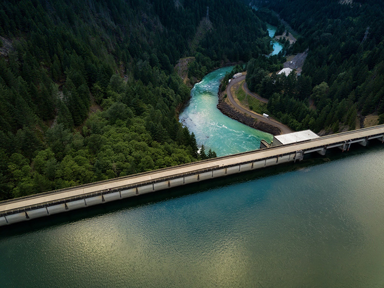
Gravity dam in Marion County, Oregon. Photo by Dan Meyers.
Photo by Dan Meyers/Unsplash

Sustainability is not just achieved through solar panels and windmills. Of course these help, but one organization is working to tackle sustainability on a larger scale: I-GUIDE is a collaborative environment for sharing and using geospatial data. It is community-oriented and works to address sustainability challenges.

“I-GUIDE” stands for “Institute for Geospatial Understanding through an Integrative Discovery Environment.” This project is funded by the National Science Foundation (NSF) under the Harnessing the Data Revolution program. Awarded in 2021, the institute is led by PI Shaowen Wang, head of the Department of Geography and Geographic Information Science at the University of Illinois. The institute has partners from across the country, including MBDH collaborators such as EarthCube, CUAHSI, the University of Minnesota, Columbia University, and the Discovery Partners Institute.

As the I-GUIDE site states, “most challenging sustainability and resilience problems today require expertise from multiple domains and geospatial data science.” I-GUIDE acts as a main point for qualified entities to access varying types of data. For example, I-GUIDE allows other participating entities to access the data stored in HydroShare, a system from CUAHSI, the Consortium of Universities for the Advancement of Hydrologic Science, Inc. The HydroShare infrastructure can be used to share data as well as analyze and visualize those data. I-GUIDE brings together other related programs. This allows increased knowledge on the subjects of sustainability, and the supporting data. I-GUIDE currently has data being added to it in the fields of water, geospace, geography, and the atmosphere.

“The institutional collaborations facilitated by this project will enable the I-GUIDE team as well as the broader community to explore a wide range of interdisciplinary science questions that leverage an interconnected network of software and cloud infrastructure,” said Dr. Anthony Castronova,
Senior Research Hydrologist at CUAHSI. “These types of institutional connections are critical to support water science research around pressing environmental issues that require modern software, data, and modeling approaches.”

Environmental issues often present themselves in one way (e.g., a drought) when the problem at hand is much larger than the assumed cause (a lack of rainfall). As the climate changes, droughts and other environmental changes can become increasingly harmful to current ecosystems. HydroShare cultivates collaboration in water-focused areas such as drought conditions, water quality, temperature, and soil moisture. These data act as the first step to help promote sustainability and resilience.

I-GUIDE holds regular webinars. The first in the series, held on March 23, 2022, explored the need for geospatial education when sustainability is growing more important every day. Led by Eric Shook from the University of Minnesota, the webinar emphasized the need for building diverse communities of instructors and learners to build best practices for cyberinfrastructure (CI) literacy, and lower the barriers for learners new to CI.

“The Midwest Big Data Innovation Hub is pleased to be a partner on the I-GUIDE project,” said MBDH Executive Director John MacMullen. “This is a diverse and talented team that will have important impacts on key areas of focus for the MBDH, including water data, CI workforce development, and data-enabled resilient communities.”

“MDBH is a great example of how our I-GUIDE Partners are organizations and institutions that share common goals and objectives,” said George Percival, co-lead of I-GUIDE’s Engagement and Partnership Team. “The I-GUIDE Partnership Program provides the pathway for Partners to contribute to and gain from the I-GUIDE activities based on mutually beneficial agreements. As the MBDH objective “to build and cultivate communities around data” is highly aligned with I-GUIDE, it is anticipated that the MBDH and I-GUIDE partnership will benefit both activities.”

If you’re interested in getting involved with I-GUIDE, please take a look at their News & Events page. The site often lists such events as webinars and symposiums. The I-GUIDE team held its first All-Hands Meeting in May 2022.

Get Involved

Activities to build the community of Midwest researchers and practitioners in the Smart & Resilient Communities priority area of the Midwest Big Data Innovation Hub are continuing throughout 2022. Contact the Hub if you’re interested in participating, or are aware of other people or projects we should profile here. The MBDH has a variety of ways to get involved with our community and activities.

The Midwest Big Data Innovation Hub is an NSF-funded partnership of the University of Illinois at Urbana-Champaign, Indiana University, Iowa State University, the University of Michigan, the University of Minnesota, and the University of North Dakota, and is focused on developing collaborations in the 12-state Midwest region. Learn more about the national NSF Big Data Hubs community.
Water Data Forum Webinar Series

Header for the Water Data Forum web series presented by the Cleveland Water Alliance, Water Environment Federation, and Midwest Big Data Innovation Hub.

Water Data Forum, the virtual series presented by the Cleveland Water Alliance, Water Environment Federation, and Midwest Big Data Innovation Hub, is returning for a second season in 2022!
In 2021, the Forum assembled expert panels to engage in timely topics such as new sensor and control technologies as well as water data for environmental justice and climate resilience. This year, interactive web sessions will engage a diverse array of experts across sectors in an exploration of topics ranging from the intersection of cyber security and water to STEM and youth empowerment.

2022 Sessions

The new season will kick off this March with a session titled: Innovations in Water Quality: The Real-Time Revolution on March 30 at 12 p.m. ET. This session will convene industry, government, and research experts to explore the next generation of water quality sensing technologies. In a facilitated discussion, panelists will use specific case studies to examine the challenges posed by new, or more recently understood, sources of water pollution and the opportunities surrounding real-time networks and new sensing modalities.


May Session: Cyber and Water: Driving Digital Security across the Water Sector
July Session: Smart Stormwater: Data-Driven Response to Flooding, Erosion and other Natural Hazards
September Session: Water Education: STEM, Youth Empowerment and Workforce Development
November Session: Smart Water Equity: Data-Enabled Affordability, Justice and Sovereignty

Robust, accurate data are crucial for the future of water resource management, economic and workforce development, and technological advancement. Water Data Forum aims to demystify the complexities of water data for seasoned experts as well as the general public. For more information and updates around speakers and registration, visit https://clevelandwateralliance.org/wdf.

Get involved

Contact the Midwest Big Data Innovation Hub if you’re aware of other people or projects we should profile here, or to participate in any of our community-led Priority Areas, which include Water Quality. The MBDH has a variety of ways to get involved with our community and activities.

The Midwest Big Data Innovation Hub is an NSF-funded partnership of the University of Illinois at Urbana-Champaign, Indiana University, Iowa State University, the University of Michigan, the University of Minnesota, and the University of North Dakota, and is focused on developing collaborations in the 12-state Midwest region. Learn more about the national NSF Big Data Hubs community.
Community Engagement through Open Watersheds

By Qining Wang

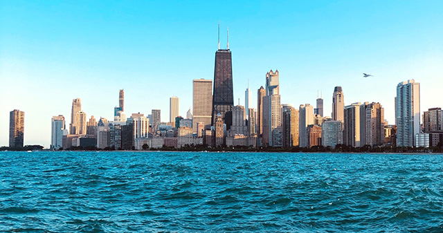
Lake Michigan and the Chicago skyline. Photo by Muzammil Soorma.
Photo by Muzammil Soorma via Unsplash

Many living in and outside of the USA presume clean water to be universally accessible in the USA. In reality, many people are living in a water crisis.

A recent study published in Nature Communications assesses the degree of the clean water crisis. Researchers found that as of August 18, 2020, more than 22,000 community water systems are either serious violators of or in significant noncompliance with the Safe Drinking Water Act. As the researchers point out, “our findings demonstrate that the problem of water hardship in the United States is hidden, but not rare.”

A huge underlying cause is inaccessible data on water quality. Different governmental and state sectors, such as the National Oceanic and Atmospheric Association and the Environmental Protection Agency, collect data on various water sources. Yet, the lack of communication among different sectors creates fragmentation of watershed data. As a result, watershed data is widespread, difficult to locate, and sometimes wholly inaccessible. Such fragmentation significantly limits policymakers’ ability to make informed decisions to improve water quality. Neither would consumers be able to tell when their water is unsafe.

One solution is to create open data hubs that centralize accessible and interpretable data, which would require both governmental and nongovernmental efforts. As such, the creation of open watersheds manifests in interesting intersections of community empowerment, resident engagement, and watershed management. In a recent panel discussion titled “Open watersheds: Innovations in Community Water Data,” four panelists involved in open watersheds in the Midwest discussed the benefits, challenges, and opportunities in open-source environmental monitoring.

This panel discussion is part of the monthly Water Data Forum webinar series, co-hosted by the Midwest Big Data Innovation Hub, the Cleveland Water Alliance, and the Water Environment Federation. The participating panelists were Whitnye Long-Jones, founder and executive director of Organic Connects; Mark App, project manager of the Great Lakes Data Watershed; Barb Horn, expert facilitator and steering committee member of the Water Data Collaborative; and Brandon P. Wong, president and co-founder of Hyfi.

Envisioning Open Watersheds

Each panelist had their own vision for open watersheds. Despite coming from different backgrounds, all agreed on the importance of recruiting community effort. Wong spoke from a technological standpoint by relating open-source technologies to open watersheds. He said: “I think there’s a responsibility to see what’s going on underneath the hood.” When it comes to open watersheds, there should be transparency in the process, from data collection from physical devices to data storage. Wong believes that open technologies will allow people to speak openly about what they know about the watershed, knowing how the data is collected and processed.

Long-Jones mentioned creating connections with community members. Since data scientists tend to use jargon and terminologies to describe water data, it is crucial to train community members to make water data more interpretable. Horns reciprocated this point and talked about cultivating relationships between residents and institutions.

Tools for Open Watersheds

Panelists further discussed building connections and relationships when talking about different tools that can benefit the communities. Horn made a crucial point about building healthy relationships with new technologies that facilitate data collection: “Too often technology comes in with its excitement [. . .], but no one has spent that time helping them build the context on how to use it, so it just becomes a strategy that actually has a short-term gain but not long still sustainability even if it could have.”

Horn also explained using data and technology to serve “wholism.” In other words, we should use new technologies to collect data that foster collaboration and innovation. New technologies should not mean to create competitions that only profit a minority of people. “It’s not the community versus the agency or the Agency. It’s not the company industry against the community. It’s like, how can this [new technology] serve wholism? How can this technology serve us coming together in a whol[ly] innovative way?” Horn said.

Regarding the current challenges and barriers, App discussed how the lack of consistent standards in water data collection creates difficulty in data integration. He suggested creating new visions around watershed data. In those visions, data collection would not merely be the responsibility of isolated entities but would be up to the whole community. Skillful community members such as retired NASA engineers, motivated high school students, and computer professionals in pattern recognition can all contribute to monitoring water quality. He believes that those new visions will be the driving force to create open standards in open watersheds.

Open Watersheds and Beyond

The panelists also discussed the benefits of open watersheds beyond open-source data collection and environmental monitoring. Long-Jones emphasized that the community efforts in open watersheds can greatly benefit areas experiencing disinvestment due to historical redlining. “Now you’re seeing some of that even still continuing when we’re talking about cities [that] are experiencing dirty, unclear drinking water,” she said. Many residents in those communities struggle to meet their basic needs, and their survival priorities come before monitoring the contaminants coming out of their faucets.

In this regard, Long-Jones encourages us to envision communities beyond geographic boundaries and be open-minded and humble when engaging with community members bearing diverse backgrounds. Only by truly listening to each other and understanding where each of us comes from can we realize that open watersheds and improving water quality require everyone’s involvement.

Get involved

You can get more involved with open watersheds by participating in the Cleveland Water Alliance’s Smart Citizen Scientist Initiative, a movement that encourages youth, elder, and underrepresented citizen scientists to collect open-source data on Lake Erie with simple technologies. You can also join upcoming Water Data Forum sessions.

Contact the Midwest Big Data Innovation Hub if you’re aware of other people or projects we should profile here, or to participate in any of our community-led Priority Areas, which include Water Quality. The MBDH has a variety of ways to get involved with our community and activities.

The Midwest Big Data Innovation Hub is an NSF-funded partnership of the University of Illinois at Urbana-Champaign, Indiana University, Iowa State University, the University of Michigan, the University of Minnesota, and the University of North Dakota, and is focused on developing collaborations in the 12-state Midwest region. Learn more about the national NSF Big Data Hubs community.

Integrating Regional Water Quality Data with the Upper Mississippi Information System (UMIS) Project

By KJ Naum

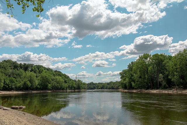
Photo of the Mississippi river near Fort Snelling & Minnehaha, Minnesota
Photo by Mathew Benoit on Unsplash

As the Mississippi River flows from its source in northern Minnesota to its mouth on the Louisiana coast, its waters cross the boundaries of ten states, picking up a lot along the way. This includes nutrients such as nitrogen and phosphorous, which contribute to “dead zones” where the river drains into the Gulf of Mexico. Dead zones occur when too much nutrient pollution causes algae to grow excessively. When they die, the decaying cells consume oxygen, depriving other life forms of the oxygen they need to survive. This condition, known as hypoxia, can lead to the devastation of entire ecosystems if left unchecked.

There’s not a lot of mystery about what causes nutrient pollution. Widespread agricultural practices in the Midwest’s Corn Belt encourage the plentiful use of nutrient-based fertilizer, so much so that much of it washes away even before the crops can use it. But trying to understand how it’s happening remains a challenge. The data on the river is as free-flowing as the water itself—and often just as slippery.

“Lots of people are doing water quality monitoring, and there are maybe hundreds or thousands of water quality parameters that can be tracked,” says Chris Jones. Jones is a research engineer at the University of Iowa, who works with the Upper Mississippi Information System (UMIS), an online platform that aims to make this deluge of data more accessible and manageable. Jones also works on the Iowa Water Quality Information System (IWQIS), an ongoing effort that informs this newer project. IWQIS makes real-time water quality data from within the state of Iowa available to researchers and the general public. However, the UMIS team is thinking bigger than that. Jones notes, “Watershed boundaries are different from political boundaries. We have to think within their context if we’re going to improve water quality, and so our vision was to bring the IWQIS concept to a larger geographical area.” The Upper Mississippi Information System aims to do exactly that. A team of researchers at the University of Iowa, Iowa State University, and the University of Illinois at Urbana-Champaign are working together on building the UMIS platform and wrangling the data for public consumption. The online platform provides one-stop access to independently managed data streams—both real-time and historical.

The initial site is live, and Jones characterizes it as about halfway complete. The biggest task for the team is to acquire still more data through building partnerships with other organizations. “We’re mainly focused on nutrients like nitrogen and phosphorus right now, but some other data will likely be available,” Jones says. “We had to start somewhere. This is a good place to start because it’s what many people are most interested in.”

Despite the widespread interest, combating nutrient pollution in the Midwest is an uphill battle. Unlike other U.S. water systems like the Chesapeake Bay, the states of the Mississippi basin have chosen not to regulate nutrient reduction, thanks to a powerful agricultural lobby that is opposed to such mandates. Instead, the state governments each try to promote and incentivize more widespread adoption of practices that reduce nutrient flow. 

Jones, however, is skeptical that meaningful change can happen without collaboration. “The states will have to work in concert in order to have any meaningful impact on solving hypoxia,” he says. “That means giving scientists access to a lot of data. Having access to sound scientific data is critical for making policy.”

Individuals and organizations that are interested in the UMIS project can sign up to be a data partner or beta user via the UMIS website, or contact the team via email. Jones and the team are hopeful that UMIS will help drive change at the scale that is needed. “Nutrient pollution is one of the wicked problems, along with climate change, but we know there are solutions out there,” he says. “Solving this is a sociological and economic issue. Hopefully, UMIS can be a tool for policymakers to do just that.”


Get involved

Contact the Midwest Big Data Innovation Hub to suggest other projects we should highlight on this blog, or to participate in any of our community-led Priority Areas.

The Midwest Big Data Innovation Hub is an NSF-funded partnership of the University of Illinois at Urbana-Champaign, Indiana University, Iowa State University, the University of Michigan, the University of Minnesota, and the University of North Dakota, and is focused on developing data science collaborations in the 12-state Midwest region. Learn more about the NSF Big Data Innovation Hubs community.

Profile: Crystal Lu

Nitrogen reduction in the Upper Mississippi River Basin

By Katie Naum

As extreme climate events become more frequent, some of their impact is visible—like the derecho that tore through Iowa in August 2020, leaving a wake of destruction in its path. Other impacts—including nutrient pollution in water systems—are less understood. In what ways will climate change affect the world around us? How can we use data science to better understand and adapt to the impact of climate extremes? 

Chaoqun (Crystal) Lu portrait
Chaoqun (Crystal) Lu

Chaoqun (Crystal) Lu is a quantitative ecosystem ecologist and assistant professor at Iowa State University, and a collaborator of the Midwest Big Data Innovation Hub. Her work focuses on water quality modeling, including the impact of extreme climate events and human activities on nutrient pollution. Her recent NSF CAREER award is titled “Understanding the dynamics and predictability of land-to-aquatic nitrogen loading under climate extremes by combining deep learning with process-based modeling”. The project will bridge the gaps between science and practice, sharing the most current knowledge of Earth system modeling to the public and making the complex concept of watershed management more concrete for the next generation of scientists, land managers, policy makers, and voters.

I spoke with Lu recently via Zoom to learn more about her work with water quality data. The following conversation has been edited and condensed for clarity.

Why is it important to study water quality here and now?

In the United States, nearly 60% of coastal rivers and bays have been degraded by nutrient pollution. Here in the Midwest, people have invested a lot of money and effort over the years to reduce nitrogen pollution. At the same time, climate-driven variations may far outweigh the effects of these nitrogen reduction practices. Increasing summer humidity, more frequent heavy rainfalls, and extreme floods have become a new normal in the central United States over the past few decades. There are a lot of unknowns about how extreme climate events have affected nitrogen leaching from soil and nitrogen loading through tiles, streams and rivers. Lots of data exist, though! 

Policymakers need science-based management suggestions. As a researcher, I would like to benchmark my model with long-term measurements of water quality, and scale up from site-specific measurements to a broader region such as the Upper Mississippi River Basin. If we can figure out how to reduce nitrogen pollution here in the Midwest, the solution we come up with will be very likely to be effective elsewhere. 

Can you tell readers more about the focus of your work, including your recent NSF CAREER award? (Congrats!)

I’m engaged in water quality modeling projects—studying, for example, the impact of nitrogen reduction practices on water quality. Our research team uses mathematical models to represent the physical processes involved in connected systems—the flow of water, the amount of nutrients used by plants or lost to runoff. We also quantify how climate change, land uses, and human management practices could affect nitrogen loading, and assess the effectiveness of nitrogen reduction practices in cleaning water.

The focus of this CAREER award is on how extreme climate events may affect nitrogen loading. My team wants to see how sensitive nitrogen leaching and loading are to events like these, which are increasing in the Midwest. We’re integrating machine learning approaches with a traditional process-based hydroecological model, using a large volume of water quality monitoring data that drains from various sized watersheds in the upper Mississippi–Ohio river basin. I want the key processes represented by traditional process-based models to be kept for water quality prediction, and at the same time improve the models’ outputs with “big data” and machine learning. Our integrated model uses data on water quality, weather, land cover, and human management practices, to better understand whether and where there are nitrogen pollution hotspots in the region. 

What are some of the challenges in working with water data? What are the insights you hope to gain from your research?

One important challenge is just the enormous amount of variation in the data. If you look at a time series for hydrological flow, you see huge variation in the relationship between flow and nitrogen concentration. The challenge we have is to quantify how varied and why. Why do some small watersheds have larger variations than others? Why are some regions more sensitive to climate than others? Is this pattern we’re seeing caused by a specific event, or the legacy of many such events over time? We want to get the whole picture on nitrogen dynamics, from vegetation to soil to water to rivers, from small to large watersheds, at daily time steps, using modeling to recreate such processes.

In our work under this award, we’re planning to include more small watersheds and high frequency data sets. I’m looking forward to new insights from such data analysis. There is so much data over the past few decades to work with, and the technology of water quality monitoring has really improved.

How does deep learning contribute to watershed management?

Deep learning has been transformative for hydrological science and earth system science, yet few studies have used it to digest the big data of water quality monitoring. Meanwhile, high-frequency water quality monitoring data are increasingly available, especially in smaller watersheds and at shorter time scales. This brings new opportunities to test the relationship between flow and nitrogen concentration in response to climate extreme events. All of this motivates me.

Do you consider yourself a data scientist as well as an ecologist? 

I consider myself an ecosystem ecologist, with data science skills. The question I want to find answers to are mostly ecological questions. Sustainability science, biogeochemical cycles, climate variability, natural and human drivers—these are all ecology questions. I say this even though I received training in ecosystem modeling and geospatial analysis for many years—but I consider these tools, the same way I consider machine learning a tool. I always keep my eyes open for tools that can help answer the ecological questions I care about. I tell my students this too: even if their degree or job title says ‘ecosystem modeler,’ I always hope they will step back and see the big picture.

How might interested stakeholders learn more or get involved?

We’ll be developing a project webpage where we will release research findings, future publications, and other relevant materials. Our results will be presented and disseminated to interested stakeholders through our collaborating institutions—not only to academic investigators, but also to the general public, because they are the people who actually make decisions on managing the land and improving the environment. 

This is a very multidisciplinary project, and others may have different ways of thinking about and analyzing the problem that we haven’t considered. We would love to hear from other researchers interested in analyzing the problem from another angle. We are also working actively to seek collaborators and more grants to leverage this project, putting available data sources online to allow easy access.

What do you love most about your research?

Being a modeler is a very precious role. Through multi-scale modeling, we try to connect a lot of different people—field scientists, computational experts, engineers, economists, stakeholders, and policy makers—who can work together to understand and build a more sustainable world for us to live in. This provides a lot of opportunity to collaborate with people in different fields. As a quantitative ecosystem ecologist and ecosystem modeler, I can serve as a bridge between field scientists, extrapolating their findings, and decision makers, who want to see and understand ecological outcomes. The work is really useful and applicable in real life. I enjoy the endless possibilities and the feeling that my research is useful and applicable for our world.


Katie Naum writes on science & technology, climate change, and culture. Follow her @naumstrosity and read more at katienaum.com.


Get involved

Contact the Midwest Big Data Innovation Hub if you’re aware of other people or projects we should profile here, or to participate in any of our community-led Priority Areas.

The Midwest Big Data Innovation Hub is an NSF-funded partnership of the University of Illinois at Urbana-Champaign, Indiana University, Iowa State University, the University of Michigan, the University of Minnesota, and the University of North Dakota, and is focused on developing collaborations in the 12-state Midwest region. Learn more about the NSF Big Data Hubs community.
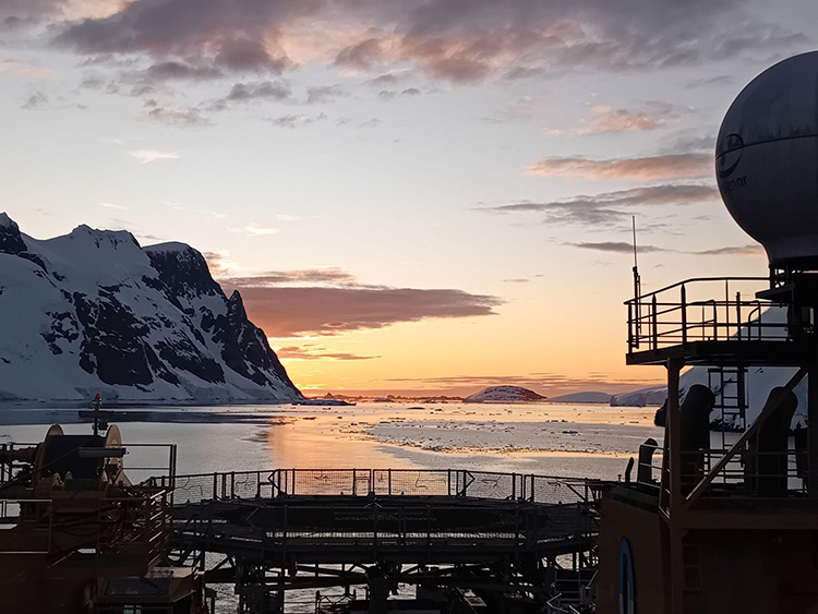
Midwest water researchers explore COVID-19 in wastewater

This story is part of a series on coronavirus research in the Midwest region

Researchers in the Midwest are looking in a surprising place for clues about the COVID-19 pandemic: wastewater.

Because so many people who are infected with COVID-19 are asymptomatic, scientists are interested in measuring the prevalence of the SARS-CoV-2 coronavirus in wastewater as a way to understand the population-level spread of the virus in communities. In-person testing can be problematic for a variety of reasons, so researchers are interested in alternatives.

Minnesota Public Radio interviewed one research group that is exploring new ways to explore coronavirus spread without directly testing people. “We’ve decided that one of the easiest ways to do that would be to noninvasively kind of scan the population for the presence of the virus,” University of Minnesota professor Glenn Simmons Jr. said. “And one easy way of doing that would be to look at the wastewater.”

Simmons, along with his collaborator Richard Melvin at UMN Duluth, are testing samples collected from wastewater treatment facilities for the presence of genetic material from the SARS-CoV-2 virus. Other researchers in the Midwest are working on similar sample collection, data analysis, and developing new tools and resources.

One resource under development is a publicly accessible, web-based Wastewater Pathogen Tracking Dashboard (WPTD). Dr. Rachel Spurbeck, research scientist at the non-profit Battelle Memorial Institute in Columbus Ohio, leads the creation of this project.

“The WPTD program is tracking SARS-CoV-2 and other viral pathogens found in the wastewater of four different locations in Toledo, Ohio over time and comparing the sequencing results to the public health and demographic data for these sites”, Spurbeck said. “This comparison will be used to generate risk models for COVID-19 spread in the community as well as other viruses present. We will also be identifying mutations in SARS-CoV-2 which will not only tell us that the virus is in the communities being studied, but also if there are any differences in the virus that could enable identification of how the virus is affecting the population and where the virus came from geographically.”

The data collected will be entered into the Wastewater Pathogen Tracking Dashboard for use by local public health officials to aid in identifying where contact tracing will be most useful. The project is funded by the National Science Foundation (NSF).

Since March 2020, the NSF has made hundreds of new awards focused on COVID-19 research to help address the pandemic. The NSF and the four regional Big Data Innovation Hubs collaborated on the creation of the COVID Information Commons resource to bring together information on these projects. Researchers can use the site to help find tools and resources, and to develop collaborations with other researchers.

Other wastewater tracking projects in the Midwest include two led by Kyle Bibby, Associate Professor of Engineering at Notre Dame university in Indiana. Bibby is leading an effort to develop methods to monitor for the presence of SARS-CoV-2 in wastewater and to connect these measurements to epidemiology models. Bibby also leads a project to create a national Research Coordination Network (RCN) focused on wastewater surveillance, in collaboration with partners from Howard University, Stanford University, Arizona State University, and the Water Research Foundation.

At the national level, the U.S. Centers for Disease Control and Prevention (CDC) has announced the development of a National Wastewater Surveillance System (NWSS) that collects data from local, state, tribal, and territorial health departments to supplement the efforts above.

Get involved

Contact the Midwest Big Data Innovation Hub if you’re aware of other projects we should include here, or to participate in any of our community-led Priority Areas.

The Midwest Big Data Innovation Hub is an NSF-funded partnership of the University of Illinois at Urbana-Champaign, Indiana University, Iowa State University, the University of Michigan, the University of Minnesota, and the University of North Dakota, and is focused on developing collaborations in the 12-state Midwest region. Learn more about the NSF Big Data Hubs community.